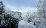
This gallery contains 9 photos.
Lots of other people are doing it, so I have been tempted by the Christmas holidays to to try and find at least one photo per year from the last decade that made me smile, or brought back a memory. … Continue reading

This gallery contains 9 photos.
Lots of other people are doing it, so I have been tempted by the Christmas holidays to to try and find at least one photo per year from the last decade that made me smile, or brought back a memory. … Continue reading

This gallery contains 1 photo.
On January 1st 2012 I published the first, tentative post on Idonotdespair.com To celebrate my fifth anniversary I have gathered together a small collection of favourite posts. Firstly your top 5 – the posts that have gathered the most visitors,some … Continue reading
 I haven’t tweeted or blogged since last Wednesday despite having a whole stack of photos and reflections from the Olympic road cycling races and the amazing performance of the British. I have felt dragged down and fed up by what I regard as the most depressing subject in cycling. For me it’s the subject that almost puts “despair” into “I do not despair”.
As a cyclist interested in sport I have lived through endless drug scandals that dragged the sport into the gutter – and the idiots that still think this is the way forward despite all the evidence that the net is closing. And I can sadly live with the need of some of our advocates to rubbish anyone who doesn’t agree with their approach.
But the discussion of cycle helmets is the cycling subject that drags me down like no other.
I feel the need to put some of this down somewhere – and perhaps to share one small ray of light I discovered in British Columbia – a place with a compulsory helmet law. So back to the blog – and of course the views here are entirely my own.
I was all fired up to blog on Thursday morning but on Wednesday evening the news broke that a cyclist had been killed by an Olympic bus, then in an interview Brad Wiggins was asked about the incident and said that cyclists should look after themselves, including wearing helmets.
It’s the evening after he has achieved something remarkable. It’s not his subject road safety. But of course the BBC has to go major on “Bradley Wiggins calls for compulsory helmets” because they have umpteen hours of news channels to fill.
By Thursday morning London Cycling Campaign and CTC are in full defence mode and even the President of British Cycling has to tackle it when he is speaking about the fantastic system for developing talent that BC has put in place. To be fair, they all did a great job. (More here)
The twittersphere, bloggers, discussion boards were full of fire and fury swamping any pleasure that could be taken from Wiggins and Froomes’s feats and the later victories of the track team. Wiggins was slagged off by the community that just hours before worshipped him.
Somehow I lost interest in the on line cycling world for a few days, I have just treated myself to enjoyment of the sport on TV and the pure pleasure of riding.
It’s not just the UK. Campaigning groups in Spain have been stunned by an out of the blue announcement by a minister to say he wanted to introduce a compulsory helmet bill causing them to have to mobilise both national and international support against the proposal.
And at Velo-city Global 2012 in Vancouver the existence of a compulsory helmet law in British Columbia and the presence of so many advocates from helmet free Europe was just the combination needed to stir the debate endlessly.
Cards on the table. I am 100% against compulsory helmets. I despise the victim blaming that characterises so much reporting about cyclists’ deaths. I have despaired with families because a defence lawyer tries to suggest that not wearing a helmet was a form of negligence by the victim.
But I also wear a helmet – for mountain biking and when I used to race.
When I came to work in cycling back in 1998 I had no idea that this would be one of the discussions that would claim far too big a chunk of my life for the next 15 years – and no doubt will be around for the next 15. And that’s the problem – it just isn’t a subject that anybody outside a very narrow community can understand or engage with, least of all the cycle racing and MTB communities because the helmets are actually made for them – so why would people in lycra understand the issues of helmets for daily cycling?
And as a result it pits cyclist against cyclist, cycling advocate against road safety advocate, it gives free reign to the online trolls who attack cyclists and it heaps guilt on to people who have the most to give to cycling. The UK’s BBC are absolutely awful – they put all of their presenters at every level into helmets for any cycling story because they are so keen to “do the right thing” and they are part of the mindset that bullies politicians into helmets for the same reason.

Boris in helmet – Image from CYBERBORISJohnson
Even Boris Johnson was dragged into it for a brief time when he became Mayor of London, but Boris is self-confident enough to say “no” – unlike most others. I remember doing an interview on BBC Radio London at the London Cycle Show with the otherwise estimable Sandy Toksvig. Being the BBC they had to have “balance” so they got a senior industry manager from a major multi-national bike company whose company sell a lot of helmets to make the case for lids. When he totally agreed with me that compulsory helmets was a bad thing for cycling the presenters decided that this wasn’t on and started to argue with us themselves.
And perhaps worse of all is the pressure on parents and cycling supporters who feel they cannot let children cycle without the dreaded plastic lid unless they become labelled “bad parents” or “negligent”.
But I am just deeply saddened by the debate itself, the resources it consumes and the time and energy we have lost as a community on a debate we just are not winning and can hardly win without risking damage to ourselves during the fight. Because if society was based on intellect and analysis nobody would speed, everyone would ride bikes, climate change would be resolved and nobody would smoke. And despite the efforts of some researchers who are bashing away some poor studies from years ago offers the pro campaigners their academic fig leaf, along with the comparisons they make with other undoubted road safety successes like seat belts.
www.Cyclehelmets.org is an amazing resource and I am in deep admiration for the team of volunteers and professionals that contribute to it, it would be foolish of me to try and replicate any of those resources here.
But I did amazingly discover one small antidote in Canada, despite the compulsory helmets. Whistler is an interesting case study for all sorts of cycling issues and I will be blogging about it more.
But this community of hardened mountain bikers showed how life really could and should be in relation to helmets. Riders who actually understand cycling risk better than anyone behave in ways that just make sense.
Downhilling?
High speeds, high risk of falling? Big impact if you get it wrong? Then it is full face helmets and even body armour. Even the designs take their lead from skiing and snowboarding as can occasionally be seen when the two take place together.


 Offroad cross country – roots and rocks creating a falling hazard?
 Without the high speeds and the jumps of the downhill tracks the risk is lower and the impact speed is within the spec of the usual cycle helmet. The modern cycle helmet evolved from this world and it is entirely reasonable that it was designed for exactly this use.
 The ride to town, or to and from the slopes?
Despite the compulsory helmet law this community knows that the good network of cycling facilities, traffic free town centre and the general understanding that motorists know cyclists are around means that the helmets are irrelevant to their safety.
And no sign that the local police feel any need to do anything about to enforce a law that was dreamed up by remote politicos in Vancouver, they recognise that cycling visitors are an engine of the local economy – so why should they hassle them?
Whistler – common sense helmet use. If only the rest of the debate was this easy.
 I was quite disappointed with the lack of resources on the web when I was researching my recent cycle tour in British Columbia. It was only a short trip in summer so the risks of getting anything significantly wrong were quite low but it was quite a frustrating process.
Putting “cycle touring” or “bicycle touring” British Columbia into search engines most of what I found was commercial tour operators or tourism sites that then provided no content or links to mountain biking centres. This may be linked to how few cyclists I actually saw. It was the height of summer and I only saw three tourists despite the amazing routes I was riding.
Half a dozen useful comments might have alleviated some angst, so for what it is worth here are the things I wish I had known before I set out, written down to help any future travellers, in particular those more used to touring in Europe. It is not at all a definitive guide, it would be great if someone in BC gave some thought to this, it would really help.
Route planning – roads
My biggest fear was the fact that the bulk of the route seemed to offer nothing but main roads including Highway 1 which in any country probably indicates a very major route.
I spend time online and looking at maps to see if there were alternatives because I was quite concerned and I really couldn’t find any advice. Certainly most of the bike routes online seemed to use main roads so I guessed I would be OK.
In reality I didn’t have much to worry about for three main reasons.
 However I will give this a health warning. There were some busy sections I cycled near Kamloops and Kelowna, but in both cases there were alternatives near these larger towns. My section of Highway 1 was bypassed by an alternative new route and when the two sections recombined it was much busier. The short section of a major truck route on Highway 97 North/South just north of Cache Creek indicated that this might not have been so much fun had I chosen to follow it for a long distance. And some colleagues reported that they felt that the provision of a cycle route alongside the 4 lane highway from Vancouver to Whistler just did not look safe because of vehicle speeds, but the person who rode it didn’t complain and I felt it didn’t look too bad from the bus.
However in general I would strongly say that even these specific examples were manageable and the rest were amazingly quiet and I really don’t know why I worried.
Second health warning – I wonder what this is like nearer to winter, because I guess snow could fill the shoulders even if the road is ploughed for vehicles.
I would also flag that there were really no alternatives except dirt roads in many cases. For example I spent a lot of time looking at alternatives from Cache Creek to Kamloops to avoid Highway 1. I thought it might be possible to go to Ashcroft and follow dirt roads to Savona. But I looked at several sources on paper and on line but I never really did work out whether the road went through, and one mystery line turned out to be a railway, not a road!
From the plane on my way back to Vancouver I got a much better understanding of the wide network of dirt roads in the back country because the dry weather had dried them to a yellow sand or clay colour which contrasted to the forest well. However I would not have wanted to risk them without very good mapping and a satnav or compass, and a full mountain bike because there was not a flat section in sight.
Maps and routes
I bought a map of Southern British Columbia from Amazon before I left for some route planning and stupidly managed to lose it but it was okay for planning. (British Columbia South: ITM.113)
So in Vancouver I looked for some alternatives. It was a complete disaster. The one and only map shop in Downtown Vancouver had closed and the alternative shops had a rubbish selection of town maps or maps on a huge scale that did not give enough detail for cycling. I thought I might do better in Whistler, but for an outdoor town the selection was to my eyes still really poor.
The only maps that appeared anything like the detail I would expect were a couple of atlases calling themselves “Backroads” atlases aimed at 4 Wheel Drive vehicles or Trail motorbikes. However the atlases did not cover all of my routes and would have cost me over $50 for limited benefit.
In the end I navigated using Google Maps, Bikely and pages torn from tourist guides for each region. This was of course possible because of my first point above – I was sticking to the main roads and so very large scale maps were all I needed. And in reality the maps on sale tended to meet that need – a country where the long distances mean people need big maps just to travel between population centres, or detailed local maps for the back country trails used to get into the woods or hills. Neither of these really work for the cycle tourist, but in hindsight I was not significantly disadvantaged by a lack of maps.
Real credit must go to online bike route website Bikely. Almost every road I wanted to ride had been covered by someone who had done it before so maps and profiles were available. It occasionally took some detective work to isolate just the section of road I needed and combine it with others to get an overall profile. But other sections were a perfect match, another rider doing just the same section. The key elements I needed were the confidence that the main roads were rideable and the route elevation profiles which told me the climbing. I also found mapping site geokov map maker which was great for topography.
The other thing I didn’t really find online but I now know exist are some interesting long distance cycle routes which might well have been good to try and incorporate had I known. Simple but bonkers fact is that the Trans-Canada Trail web site does not contain the word “touring” anywhere so will never be found in a search engine looking for cycle touring routes.
 In Whistler I discovered that the Sea to Sky route which comes from Vancouver is being extended beyond Whistler and is intended to go on and link up with other Trans-Canada routes which form a greenway network across Canada. The section to the East of Whistler is going to be an offroad trail running away from the main highway. However it will be much slower than the road route because it climbs more and the surface is rougher but it will be great for those looking for leisurely and scenic riding.
I also found that I was riding close to an amazing cycle route called the Kettle Valley Trail which is part of a whole network of former railway lines. The “trestles” or wooden railway bridges and tunnels have in many cases been restored and apparently provide some great cycle routes. There are published guides and histories which would have made a good pre-read and I could have aimed to include some of them in my route had I found them beforehand. Doh!
Planning services
This route was in Southern British Columbia which is the relatively densely populated part of the province. Despite that there were long sections that had absolutely no services. I could easily have made some big mistakes and left myself without food and drink because these sections did include access to camp grounds and provincial park centres but unlike similar venues in other countries most of these had no public services such as shops or cafes. The ubiquitous RVs may partly be to blame, even campers travel with a week’s supplies on board.
However I am told the real reason even quite big and popular camping grounds have no services is because the season is so short and it isn’t commercially viable to open a business based on just a few weeks’ sales. Therefore I carried extra food and even put a filled a Camelback bladder with extra water in my panniers for a couple of legs.
The best guide I found was the web site Mile by Mile which actually specified what was available along a number of the roads I used but I would suggest caution because opening times can be a bit hit and miss too.
Bikes
The roads I used were in excellent condition and could be tackled on almost any road bike. I only experienced a couple of dirt roads and generally they were good too, but steep, up to 13% gradients.
 However I would strongly recommend consideration of a 26 inch wheeled mountain bike set up as a road tourer. The roads are steeper than continental Europe with 10-13% encountered on several occasions so the lower gears of the MTB would be useful. I was over-geared on the bike I bought, I should have got the freewheel changed as it was probably only about a 25 tooth on a road triple which wasn’t enough. But perhaps more importantly the BC mountain bike scene is vibrant and you will find spares and repairs much easier to find, even in small towns. If you are going to buy a second hand bike as I did the range of MTBs on offer is much wider too.
That doesn’t mean foregoing dropped handlebars, I have regularly adapted them on to MTBs but I used some bar ends to get a different handlebar position.
Accommodation
I stayed in motels booked through web sites apart from the Alta Vista chalet run by Bear Back in Whistler. No real plans to carry camping gear around or buy it in Vancouver.
The advantage of the motels were:
Alta Vista Chalet would be worth using as a base (if not booked out) even if you are passing through Whistler on tour. It is a little cycling mecca – everyone on the staff and visitors is a cyclist, there is a really good workshop in the basement and the food is of the type and quantity that we love!
 Final proper day of the tour – 135km to meet my friends camping by Lake Okanagan just north of Kelowna’s Westside. 271miles/440km since I left Whistler, the tour is over, a glass of local wine by the beach to celebrate.
With pained memories of my previous long day just 3 days ago and the forecasts of temperatures well into the 30s all day I studied the ride and route profile assuming a day similar to day 1 – long and hard. As it was I had one of those special days on the bike where everything seemed to work out perfectly, the scenery was great and the miles just disappeared under the wheels making it a great end to my short tour.
I shall do some roundup posts about one or two subjects when I get home, but a thoroughly enjoyable four days in a stunning country. So glad I did it.
The ride
Because of the heat I was out of the motel and on the road by 6am with the intention of bowling along the valley from Kamloops to my main climb out of the valley as early as possible.
Odd bit of signposting as I left the motel, the marked bike route sent me almost immediately onto the shoulder of Highway 1 where I was to spend the next 26km despite the fact that most of the way alongside the main highway were a combination of service roads and residential roads that would make a perfectly good linear cycle network all the way along the valley.
However today it didn’t matter, it was early on a Saturday morning so the number of vehicles was minimal and there was no wind at all.

In fact the overwhelming feeling was of a day that was going to be a scorcher. The heat haze was almost mist already down the valley and in fact it never left all day, running any prospects for good photography.
The road was just gently rolling and the hard shoulder was wide and well surfaced which just invited me to get into a slightly tucked position with my forearms resting on the handlebars and my hands just gripping the cables, reminiscent of a time trial position without tri-bars. Even the knobbly tyres seemed to roll without too much drag and I polished off the first 26km to the climb really easily.
This was slow and sticky, at least at the bottom, so I just tapped my way up easily, trying to conserve energy and not get too warm. But it was only a 400m climb alongside the relatively shallow gradient of a main road so it seemed to go quite quickly. The bonus was at the top when the road crested a small rise and dropped me into a beautiful green and fertile valley, just that bit cooler than the arid valley I had left.
At first the bottom of the valley was a flat area of grasslands and reeds fed by a steam, then the attractive Monte Lake with fishermen’s boats and a spectacular railway track hugging the far shore.

After the lake the valley opened out onto a pancake flat area of farms, many of them with sprinklers going flat out and my first signs of the famous Okanagan fruit crops with cherries for sale by the road.
Once again this road was so flat and inviting I ignored all the temptations to stop and just lay gently on my handlebars while bowling along at a really good pace. In my mind’s eye I could see those days in the Tour de France when the peleton has 200km or more to ride across the baking plains of the Vendee and the teams send the “rouleurs” to the front to just eat up the kilometres at a steady pace. Nothing like the same pace on my laden steed but the feeling of just knocking off the miles quickly was enjoyment in itself.
At the end of the open valley section the surrounding hills suddenly closed in to form a narrow V and I was descending again towards my chosen mid ride break at Falkland. Nearly 50 miles/80km achieved over an hour ahead of plan so I treated myself to a breakfast and home-cooked blueberry pie just to celebrate. I chose the rather twee café which looked like an English tea room because I liked the seat on the terrace, but I don’t know anywhere at home that also has a mural of their “Stampede” on the wall, the Falkland Stampede being the town’s biggest event of the year. I guess we would understand it as a rodeo, but I gather the rodeo is just one of the events in a celebration of all things cowboy and country.
From Falkland the road then descended at varying gradients for almost another 30km until I emerged into the north end of the Okanagan valley which features a lake 135km long. The valley is the home of a busy tourism industry, British Columbia’s wine growing and fertile farming district.
My destination was ultimately Kelowna but my friends from the city were camping at Fintry, some 30km north of the city on the west side of the lake so I was able to turn down the quiet West Side Drive to complete my trip. I was feeling so pleased with myself I initially tried to slipstream two road cyclists on skinny lightweights as they came past but that idea lasted no more than a few metres of downhill before I was gasping for breath and my legs reminded me that this was day 4.
 The road offered regular views over the lake and the houses in amazing settings, but it also meant that the ride finished with some stiff climbs up and around the headlands.

Last hill!
I was pleased I didn’t have to do any seriously big climbs, by now it was 1.30, the heat was stifling and the tarmac was melting on the road.
Arrival
Fintry was a delight, the former property of a rich Scottish man who had inherited some wealth and used it to escape to Canada and try to build a model farm on the banks of the lake almost 100 years ago. Today the old house is a museum and the area is mostly a delightful family camping ground by the lake where I was able to relax and have an afternoon snooze after a refreshing glass of white.

Fintry Mansion

Fintry Barns
I even justified carrying a can of extra strong insect spray all the way from Whistler – the only downside of the location!
Job done.
 How to give a cyclist fork to mouth resuscitation.
I think I must have been complacent after yesterday’s ride and not eaten enough breakfast because I was caught by surprise after only 25 miles when my legs went to jelly in the pleasant and sleepy lakeside township of Savona.
A big shout out to the Roadside Diner therefore, your massive Roadside Omelette with refills of coffee and sourdough toast saved me.
Traffic worries – or not?
I wasn’t sure what to expect from today. The simple facts were 85km from Cache Creek to Kamloops and only a few hundred metres of climbing. But I was quite concerned that I was now joining Canada’s Highway 1, the Trans-Canada and the many trucks seen in Cache Creek could be coming my way. Plus the forecast for Kamloops was heading for 34 degrees, so I certainly didn’t want to be out in the main heat surrounded by traffic.
I have no idea why I worried. Most of the trucks I had seen the previous day were heading north as a new link has bypassed this East-West section of Highway 1. It is amazing to see that in any country a road designated number 1 was so lowly trafficked until much later in the morning. Most of the way it had at least a 1 metre shoulder and the drivers were unfailingly courteous, pulling far wider than expected or needed as the passed me. For long periods I was alone listening to birdsong and crickets.
The only exception was as I approached Kamloops. Volumes of vehicles shot up from traffic re-joining off the alternative route and the city itself was far bigger and busier than I had imagined. I guess I had been expecting the next size up from the small towns of previous days but this is a big, bustling town, a real shock to the system.
The ride
Actually little to report. Much of the riding itself was on open arid plateau or similar wide valley, irrigated to support crops with the road visible in the hazy heat winding into the distance.
Even after the spectacular descent to Kamloops Lake at Savona the road pulled away from the lakeside most of the way, climbing quite high before a steep final descent to the city of Kamloops.
It was very hot and I am frustrated that after lavish doses of factor 30 I neglected the tops of my legs which I never need to cover at home, by June they are always well browned. But of course this has not been that sort of summer in Europe and I have a painful pink line which I won’t share.
Other reflections on the way: Savona was a sweet, sleepy place and the locals take amazing pride in their lakeside gardens and flowers, shocks of colour against the dry scrubby landscape.
But almost every other house in Savona appeared to be for sale and all the way along there were what could be dream houses for sale. The real estate collapse in Canada was very much in evidence here.
 To end.
In the big town I was quite taken aback at having to battle traffic and navigation to get to my motel.
However all was saved by the discovery of a riverside terrace nearby and a beautiful sunset. All is tranquil before another long hard day tomorrow.

 Day 2 and a complete contrast to the previous day. A much shorter ride – only 55miles/87km. This time I had checked the route profile much more carefully. Most importantly the climbing was very different. I actually was climbing for nearly half the ride, sneaking upwards a few metres at a time but spread over 25miles/40km the net gradient was shallow and there was plenty of respite.
I also got out early to miss the warmest part of the day, leaving the motel at 7.30am so I was at my destination for lunchtime, and more importantly a long Skype call home at a sensible time for my family in England. So less about the pain and suffering today and much more about the features of this part of British Columbia and another delightful ride. Good day!
New landscapes
Lillooet was being gently lit by a sun that peeped over the valley edge and highlighted the main street and the tidy buildings, including my star Greek restaurant, Dina’s.
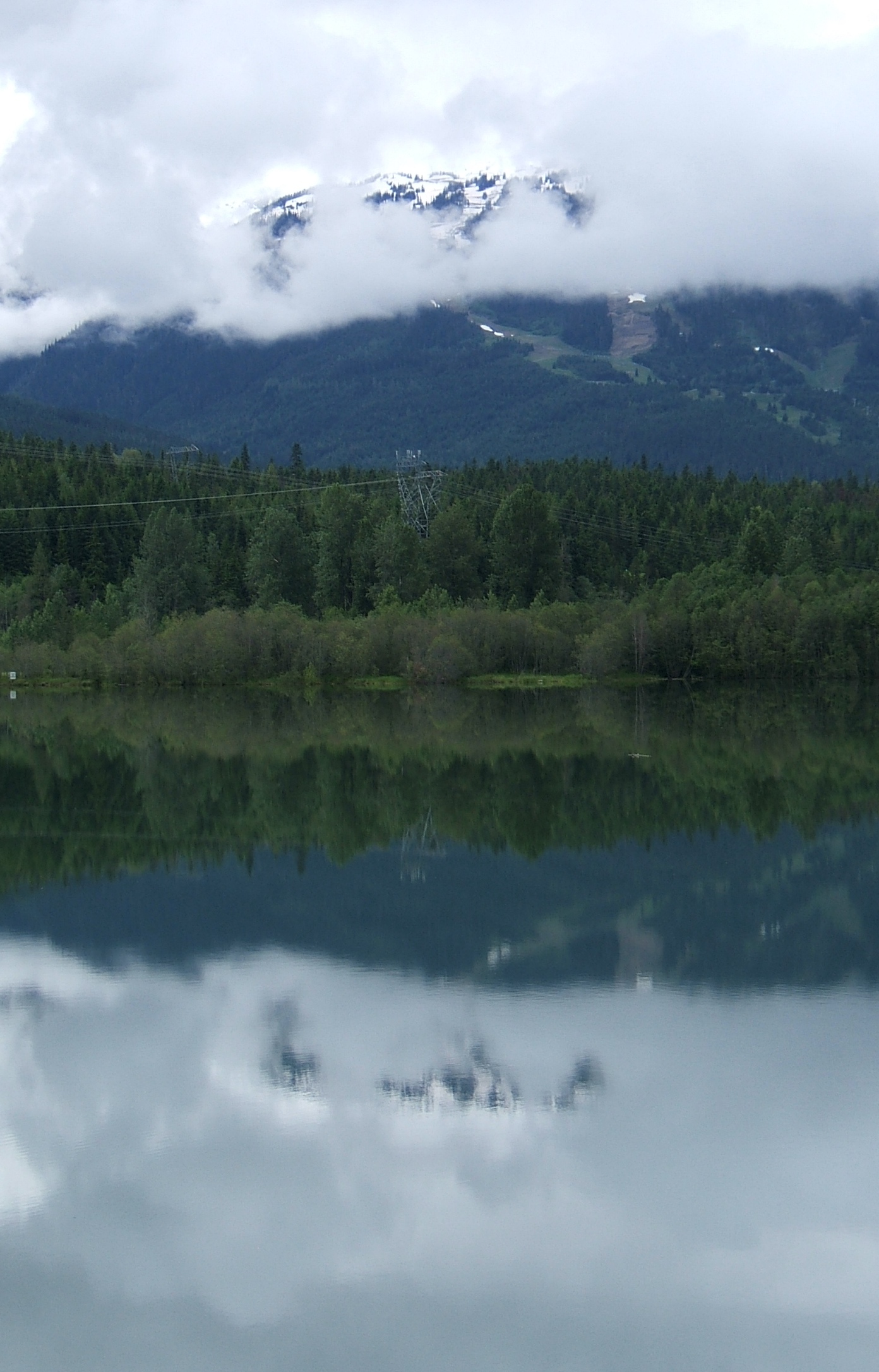
It was also clear that this was going to be a very different day in landscape terms. Even dropping into Lillooet last night it was clear this was something different. All the way from Whistler the previous ride had featured waterfalls running down from snow in the mountains. The valleys were lush and the rocks were grey.
This was now very different, arid and dusty. There was no snow to feed streams and the soil had turned a sandy red and yellow. Irrigation was being used to water the occasional flash of bright green on a farm, but otherwise the plant life was largely scrub.
The Frazer River showed its power by carving out a deep gorge in the soft stone as our road gradually gained height up the gorge side providing some spectacular views. (Below and first photo above) 
The riding wasn’t too painful this time, I could sit and ride up in my lower gears and I only needed to bounce out of the saddle occasionally for a change of position.
Pavilion Lake
After about 20miles/30km the road swung east to make the final climb up to Pavilion, Pavilion Lake and the Marble Canyon. As I had already gained half the height of the day this last steeper section went by easily and almost by surprise I reached my highest point. This allowed me a massive treat. The valley was lush, wide and inviting.
The blue of Pavilion Lake was breath-taking and I envied the people camping or owning summer houses by the water in this beautiful place. (Second photo above and below)  The lakeside road was 4miles/6km long, rippling gently up and down as I rolled along easily.
From the end of the lake the water starts to flow down towards Cache Creek but only along a long shallow valley so there were no sharp descents until the very end. Visitors from Europe would easily recognise the farming patterns, cattle out in the fertile valleys enjoying summer pasture fed by the river while the hillsides were becoming dry and barren.
There was a niggling head wind but I rolled along steadily, especially when I realised that lunch in Cache Creek and an afternoon off was an option. I even got out of the saddle and thrashed up a couple of small climbs because I wanted to – I must have been feeling better.
Cache Creek
The biggest disappointment was the end of the valley. Just 5km to go but I left my sleepy highway 99 to join a much bigger road and a blustery head wind. I put my head down in best British Time Trial mode and allowed the suction of the trucks to give me a bit of a boost every few hundred metres. I really hadn’t thought about it much before but the traffic volumes previously had been unobtrusive and unfailing polite in passing me, a strong recommendation.
And so to Cache Creek, a nondescript collection of motels and houses at a highway junction. Few redeeming features, but the motel is spotless and welcoming and I have enjoyed a laid back afternoon catching up.
Route profile credit:
There is very little on line material about cycle touring in this area. I got my information from Bikely.com and in particular the routes put up by user nozza who has done much of the same route I am riding. The image below is a screen copy of nozza’s route – please visit the site for more information and or some of the other great routes this user has done. Thank you very, very much!

 My thanks to the campervan driver with the German accent who provided the photo of the tour, probably without realising.
Many cyclists will have experienced a day like this. Exhilarating scenery. Amazing experiences. The satisfaction of taking on a ride that is on your limit. But it was hard, very hard, and at the end I was pretty much on my limit. This was always going to be me longest ride with the hardest profile but it was also the proof of whether I had taken too much risk arranging to ride across British Columbia on a heavy knobbly tyred bike I bought for $129 from a bike recycler.
Yes it would have been a much easier day on my Dawes Super Galaxy with lighter weight, narrow wheels and lower gears. Yes it is a pretty daft idea going on tour with extras like a laptop in the bags.
 But it could not have been a better day. As I say so many times it is always about the ride. And this was a special one. I have written up the day as a diary with photos, I hope they capture something of the ride, enjoy wonderful British Columbia. They had better be good – I haven’t carried this laptop for nothing!
Departure
It was with some trepidation that I left the cosy cyclist friendly atmosphere of Alta Vista Chalet to head north to Llllooet.
I am I knew I had about 85m/135km with a really tough climb  en route which I had estimated at around 10km and 10% average gradient from my research on Bikely.com. (acknowledgement below) The unknowns were how I would cope after two hard days mountain biking in Whistler and whether the gears on the recycled Raleigh were really low enough for the very relaxed attitude I had to luggage weight when I left Vancouver.
The first signs were great. Gaps appeared in the clouds over Green Lake at last and the first 30 miles were downhill and then flat through Pemberton to the foot of the main climb. En route the road followed the tumbling river and the longest slowest train I have ever seen.
I dropped nicely along the main road which has an excellent hard shoulder for cycling down to Pemberton where I decided on an early coffee. There is a reason for that:
I have to say the road from Pemberton to Lillooet Lake (nowhere near Lillooet town!) was an absolute delight. The road became really quiet and rolled gently along the valley floor which was verdant with woodlands, fields and wild flowers. There was a real mixture of houses, some almost imitating an English country garden, while other landscapes could only be North American.


Then Lillooet Lake itself provided some amazing views.

All a bit too easy because I knew somewhere along the lakeside the climb was due to start. Before I left the chalet I had said to the guys that my hope was that the hill wasn’t a constant 10% for the whole 10km, that it would offer some respite through the bends and contours of the hill.
Wham.
Without warning the road left the lakeside and reared up at about 10% straight away. I was bobbing in and out of the saddle almost straight away and really struggling. Instantly I was analysing that I was certainly over-geared and definitely over-laden, just as I had feared. There were extended periods of out of the saddle easing over the cranks to keep the bike moving at just 4pmh/6kmph.
I fell into the cyclist’s trick of playing mind games to accompany myself up the climb. Maybe a sip of water if I can just get round the next bend. Maybe lunch halfway up? It was hot and hard, stopping for the odd photo was one of my psychological treats.
Fortunately the gradient did ease off after about 2 miles and started to offer some variety in gradient so there were periods of sitting pedalling and others of out of the saddle heave. I was making steady progress with the mind games so the climb was probably going to take something over an hour. I was feeling tired but relieved as I neared the top and this lovely waterfall came right down to the road edge and the flowers were increasingly abundant.
 I hadn’t bargained on two things. Firstly I really hadn’t studied the route profile in intimate detail – and it turned out it was a 13km climb, not 10, and the last km was a horrible final flog up which made a big dent in my reserves. Secondly I had focussed so much on the climb that I wasn’t really conscious of the 69km on the summit sign to Lillooet – I knew it was mostly downhill so it didn’t really matter. Well it did, because scattered along that 69km was another 600metres of climbing that I hadn’t really got my head round.
 But before that the summit which provided some great views, and I guess the sign that would have helped the most at the bottom!
I guess it is symptomatic of the range of roads of Canada that what would be a significant landmark in many countries gave the most unremarkable welcome – no summit or altitude sign, no group of skinny men in lycra having their photo taken. It even has a nondescript name “Duffey Lake Road”.
Heading for home.
The first descent to Duffey Lake was a beautiful setting for a late lunch.

After the lunch break there were some amazing descents and overall the road was pretty much downhill as it tracked the river that fell steeply away. However the highway engineers seemed to have different ideas as the road wound up and down the valley sides rather than follow the river contour. This reached its extreme on the final few km before Lillooet where the road rose really steeply up and away from river which had carved out a steep gorge below. I couldn’t help but wish for the sort of Swiss engineer who would have blasted a downhill path through the rocks quicker than you can say Emmental. However it was not to be and I arrived at the top absolutely finished – my longest day in the saddle for a very long time and nothing left.

River – down left. Road – Up right!
Things were enlivened a bit on the 13% descent, I did hit about 40mph/60kmph but I really didn’t fancy leaning the luggage over on the hairpins on this bike.
And finally to dropping to Lillooet on the banks of the Fraser River, already large here and running all the way back to the sea at Vancouver.
Time to collapse in a heap, to recover and reflect. And who’d have thought it? An excellent Greek restaurant in the middle of nowhere? (or at least in the middle of town 200 metres from my motel!) The food and the two glasses of locally produced red wine went down a treat.
I slept very well.
Route profile credit:
There is very little on line material about cycle touring in this area. I got my information from Bikely.com and in particular the routes put up by user nozza who has done much of the same route I am riding. The image below is a screen copy of nozza’s route – please visit the site for more information and or some of the other great routes this user has done. Thank you very, very much!
